About
In all javascript of Mapviewer, you will have to define a center point and the zoom level. It's two important settings in order to have a beautiful rendering.
Example of javascript :
    var mapCenterLon = -122.45;
    var mapCenterLat =  37.6706;
    mapview.setCenter(mpoint);
    mapview.setZoomLevel(mapZoom);
    var mapZoom      =  0;
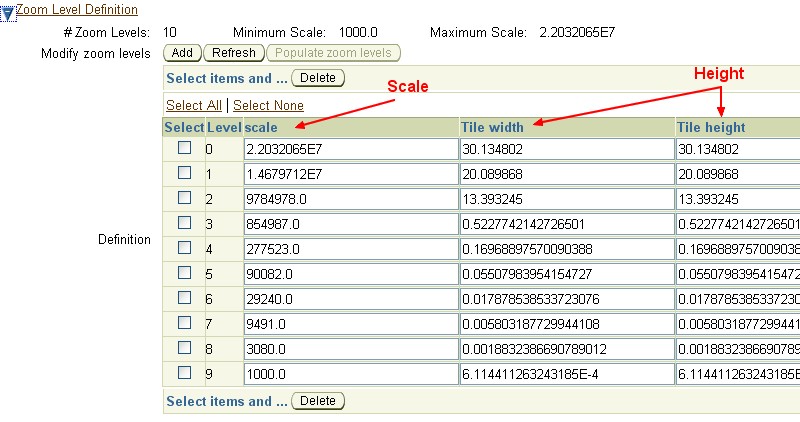
When you create a map tile layer, you have to give the coordinate system. If you gave the good informations during its creation, the zoom level definition is automatically fill with good values.
Example for the Netherlands :
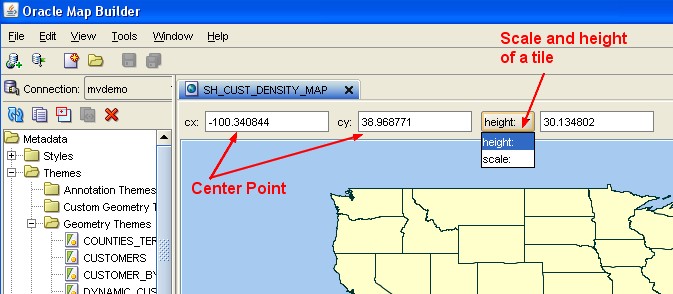
How to find them ?
The best way that I have found is to play with MapBuilder because in the render windows you will retrieve this information.
How to define the zoom level ?
- Go to the mapviewer,
- Connect with the oc4jadmin account
- in the management tab, click on the “Manage Map Tile Layers” subtab
- select you map tile layers and click on the “Edit/view detail” button
- and go to the section “Zoom level definition”