About
Before a content designer can use a map in a OBIEE map view some configuration are needed:
- import of the layers (or theme as a theme have only one layer
)
- import of the maps
- and configuration of the metadata.
And all this in the same place: Administration > Manage Map Data
Articles Related
Prerequisites
- A map must be present in the database. Example: MapBuilder - Import of a Shapefile Map
- The Map view Glossary must be known
- Mapviewer is installed with the standard installation and is configured with a connection on the database schema holding your Spatial data.
Steps
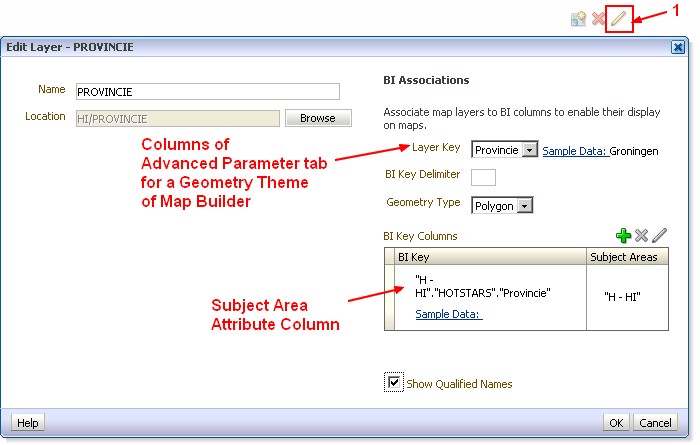
Key Layer
The layers must be configured using the Map Builder tool of Oracle Spatial.
To be able to join the map and obiee, you have to define a key layer.
The key layer in OBIEE is the column info of the theme in Map builder.
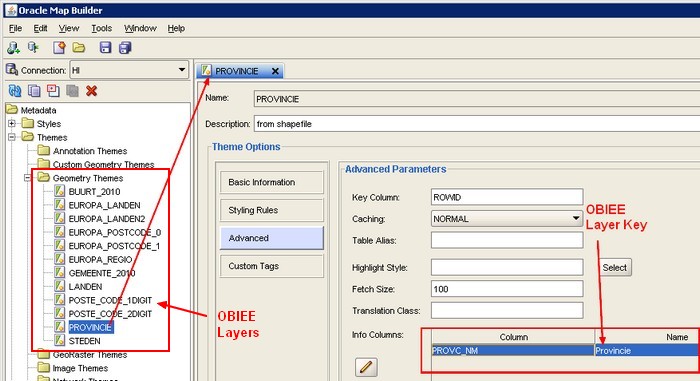
The OBIEE key layer (the name column of the info columns area) can contain spaces
Importing Layers
Before importing a layer, be sure to have added a key_layer, otherwise you may have cache problem
The first step is to select the layers for use on maps. You next select at least one map from a list. This map becomes the background on which the layers are applied. You can optionally specify images for use with map formats.
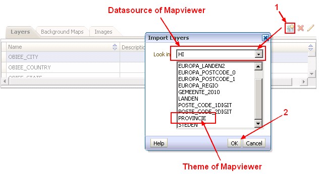
The images listed correspond to the styles defined within MapBuilder (and then stored in USER_SDO_STYLES).
Column Association
After selecting layers and maps, you associate:
- column of those layers
- with columns from the subject area.
It gives the relationship between the geometry (polygon or line) and the attribute data of OBIEE.
If the association between a column and a layer is incorrect, then the layer cannot be displayed correctly on the map. The association ensures that shape definitions can be found in the database for the column values during map rendering.